
Shadowbroker | Open-Source Self-Hosted Global Intelligence & OSINT Platform
Shadowbroker
Introduction
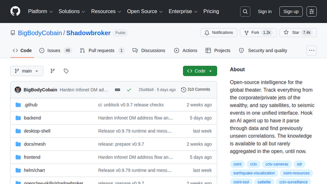
ShadowBroker is an advanced, self-hosted geospatial intelligence (GEOINT/OSINT) platform that aggregates and cross-references over 60 real-time public data feeds into a unified cyber-ops dark map interface. It combines live flight telemetry, maritime vessel tracking, satellite orbits, environmental hazards, and signal intelligence anomalies onto a localized MapLibre GL canvas. Built with a Next.js frontend and a FastAPI/Python backend, it allows analysts, researchers, and journalists to correlate independent tactical signals completely offline with 100% data ownership and zero external cloud tracking.
Use Cases
Multi-Domain Signal Correlation
Overlapping different real-time tracking streams (such as matching live flight ADS-B metrics against localized GPS jamming reports) to confirm regional electronic warfare anomalies.
Sovereign Investigative Journalism
Track private executive aircraft, follow high-value maritime cargo, and cross-reference geopolitical conflict events without creating user histories on commercial SaaS platforms.
Passive Electronic Warfare & SIGINT Auditing
Analyze passive signal accuracy categories (NAC-P anomalies) from gathered aviation transponder signals to automatically map out localized GPS jamming or spoofing footprints.
Environmental & Hazard Crisis Mapping
Overlay active global earthquake notifications, real-time wildfire tracking data, and global satellite paths to evaluate infrastructure risks during localized natural disasters.
Self-Hosted Asset Infrastructure Security
Monitor public shipping channels, open CCTV indexes, and regional political threat vectors near corporate facilities to generate decentralized alert feeds.
Features & Benefits
Unified MapLibre GL WebGL Engine
Utilizes direct WebGL rendering alongside viewport culling and GeoJSON clustering to fluidly display over 25,000+ ships and 5,000+ flights simultaneously inside a responsive browser canvas.
Fast/Slow Dynamic Ingestion Tiers
Orchestrates backend fetches using tiered loop cycles: high-velocity fast caches for live telemetry (ADS-B, AIS, Satellites) and 5-minute slow loops for historical data (GDELT news, sensors).
Passive GPS Jamming Estimation
Monitors global clusters of aviation transponder data to isolate degraded navigation indices, instantly plotting shaded threat regions on the operator map canvas.
Zero External DB Disk Caching
Eliminates heavy, external multi-tenant database infrastructure requirements by caching dynamic payloads efficiently as localized JSON and memory buffers.
Synthetic Aperture Radar (SAR) Ground-Change Detection
Features ground intelligence analysis overlays that compare radar reflections to flag real-time structural variations or physical environment developments.
Sovereign Privacy Core Crate
Includes specialized cryptographic modules supporting stealth addresses, ring signatures, and blind token validations to guarantee secure, localized team coordination.
Absolute Data and Operational Sovereignty
Licensed under the AGPL-3.0 with zero trackers or forced phone-home telemetries, guaranteeing that high-stakes analysis remains completely private.
Incredibly Low System Compute Overhead
Gzip compression and smart asset streaming allow extensive multi-megabyte geospatial matrices to bundle into highly dense, under-1MB local operational structures.
Comprehensive Out-of-the-Box Integrations
Combines dozens of disparate pipelines (OpenSky, adsb.lol, CelesTrak, USGS, NASA FIRMS, GDELT) directly into toggleable, structured layers.
Cons
Heavily Bound by API Key Allocations
Achieving maximum situational awareness across all tracking modules relies on procuring valid, separate tokens from specific third-party providers.
Higher Local Memory Allocation Profiles
Retaining heavy live global ship positions and flight trajectory clusters entirely within localized cache pools requires stable host memory configurations.